Showcase
Discover amazing maps created with SizeOnMap.com. See how countries and territories compare in size when placed side by side.
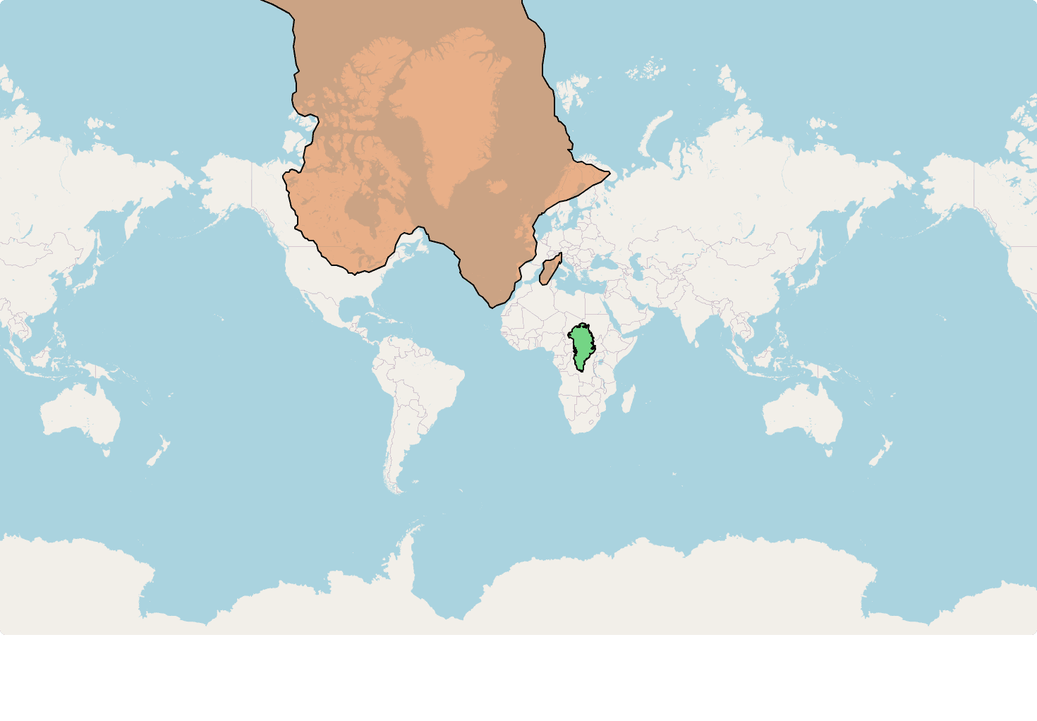
Greenland vs Africa
Greenland looks enormous on most maps, but when dragged across Africa it becomes obvious that Africa is more than fourteen times larger.
greenlandafrica
View Map
Russia vs United States
Russia appears massive on most world maps due to Mercator projection distortion, but when compared directly with the United States, its true size becomes more apparent.
russiausa
View Map
Alaska vs US Coasts
Alaska alone rivals both east and west coasts of the continental United States, revealing just how vast it really is.
alaskausa
View Map
Texas vs Europe
Drag Texas across Europe to see how it stacks up against nations like France, Germany, and Spain.
texaseurope
View Map
China vs USA
Two global giants often compared in economy and politics also have remarkably close land areas, though their shapes differ greatly.
chinausa
View Map
Great Britain vs Japan
Two island nations of similar population but very different geography—see how the UK and Japan compare in land area.
britainjapan
View Map
Africa vs the World
Africa dwarfs common expectations—move it over Europe, Asia, or North America and its scale becomes undeniable.
africa
View Map
Brazil vs Europe, Australia & India
Brazil's landmass is so extensive it can rival entire continents like Europe, Australia, and even the Indian subcontinent.
brazileuropeaustraliaindia
View Map
India vs Europe
India often feels like just another country on the map, but when placed over Europe its size stretches across much of the continent.
indiaeurope
View MapCreate Your Own Map
Ready to explore and compare territories? Start creating your own interactive maps.
Create Your Map